Lincoln Tobier
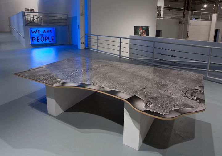
What is a Picture of Los Angeles?, 1996
- Medium
- Black and white photomontage
- Dimensions
- 156 x 192 in. (396.2 x 487.7 cm)
- Accession Number
- 2002.42.1
- Credit
The Museum of Contemporary Art, Los Angeles
Gift of Themis and Dare Michos
Using aerial photographs ordered from the US Geological Survey, Lincoln Tobier’s tabletop map gives a view of Los Angeles from the proverbial ten-thousand feet. One can see everything, but nothing is truly visible. Recalling the earlier tradition of room-scale urban panoramas, What Is a Picture of Los Angeles? was made in 1996, at the beginning of the internet mapping boom. Now we carry cities in our pockets, making the effect of Tobier’s map both nostalgic and strange.
Currently on view atMOCA Grand Avenue
Collection
Related